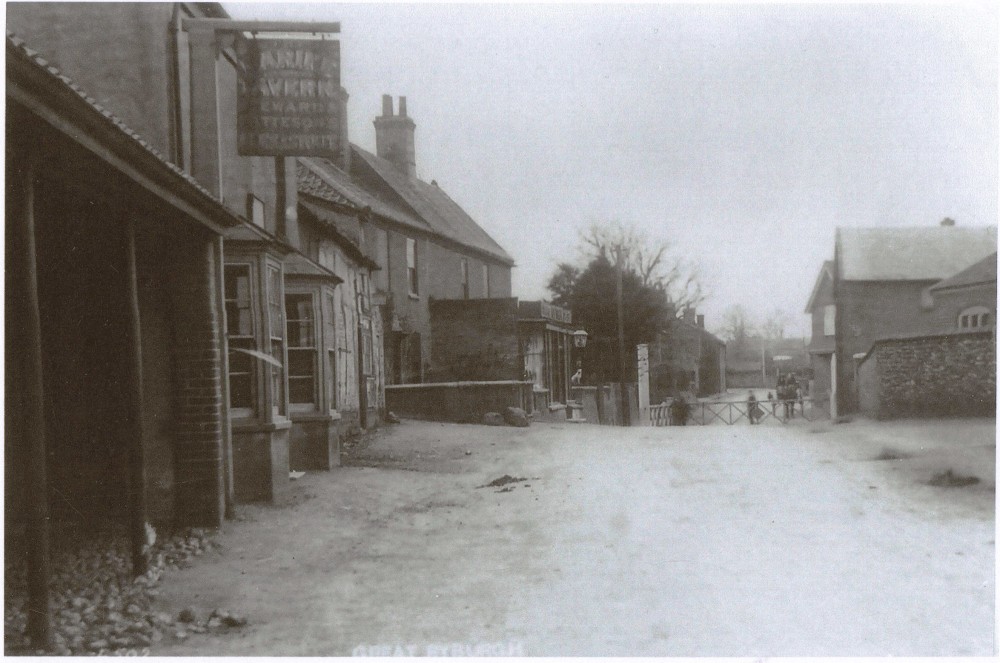
The Marine Tavern
Steward and Pattesons 1904 -1931
A list of the licensees can be seen on here the Norfolk Pubs website as a start to finding more of the history which can be derived from a number of sources including Census returns, maps and title deeds and the all important 1810 Inclosure Act which gives the earliest depiction of the site described in both words and on plan .
William Faden's map of Norfolk published in 1797 shows a very recognisable Great Ryburgh. Unfortunately the area of the street that covers the site (and the Old Hall which certainly was there on the other side of the road) is completely devoid of dwellings between the Crown and the Parsonage and must be an oversight on the part of the cartographers rather than an indication that this was barren ground.
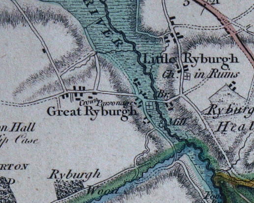
Less than 20 years later, the map produced for the Inclosure Act of 1810 rectifies the error and shows buildings on the site on the accompanying plan and the Schedule describes the plot thus:
which transcribed reads:
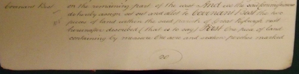
And we the Commissioners do hereby assign set out and allot
to COVENANT BEST the two pieces of land within the said
parish of Great Ryburgh next herinafter described (that is to
say) FIRST One piece of land containing by measure One acre
and sixteen perches marked on the last mentioned Map or plan
with the number 288 whereon a Messuage and other buildings
stand bounded by the first described public road in the said
parish of Great Ryburgh towards the north by the fourthly
described private road in the same parish towards the east by
land hereby allotted to the said Rector of Great Ryburgh in
part towards the South and by land hereby allotted to the
heirs or devisees of the said John Howe deceased towards
the west and on the remaining part of the South
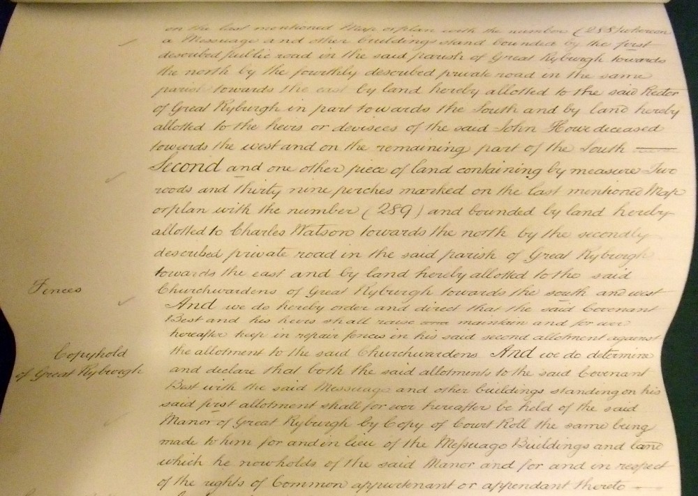
Second and one other piece of land containing by measure two roods and thirty perches marked on the last mentioned Map or plan with the number (289) and bounded by land hereby allotted to Charles Watson towards the north by the secondly described private road (Westwood Lane) in the said parish of Great Ryburgh towards the east and by land allotted to the said Churchwardens of Great Ryburgh towards the south and west AND we do hereby order and direct that the said COVENANT BEST and his heirs shall raise maintain and for ever hereafter keep in repair fences in his second allotment against the allotment to thes aid Churchwardens AND we do determine and declare that both the said allotments to the said COVENANT BEST with the said Messuage and other buildings standing on his said first allotment shall for ever hereafter be held of the said Manor of Great Ryburgh by Copy of Court Roll the same being made to him for and in lieu of the Messuage Buildings and lane which he now holds of the said Manor and for and in respect of the rights of Common appurtenant or appendant thereto
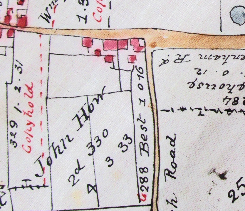
We can now see a very recognisable parcel of land and a date of 1810. The ground plan looks very similar to what is known was there at the time of the photo at the top of the page with the exception of the bay windows and boundary line with the land of John Howe. Importantly the text mentions nothing of a beer house, public house or inn.
Fortunately title deeds provide the link from Covenant Best to Steward and Patteson and show that the plot was sold by Best's widow Sophia to Meaburn Tatham Esq Patron of St.Andrew's Church and father of Revd. George Tatham the Rector. The land was adjacent to the land to the rear of the Rectory and the private road described in the Inclosure schedule could then connect with his orchards. He in turn sold it with a mortgage at the beginning of 1872 to St Andrew's churchwarden Michel Mesney who was by then owner of the plot that had been asigned to John Howe at the time of Inclosure. This transfer produced another map of the site which in conjunction with the deed of title puts this piece of land with its cottages in a completely different light: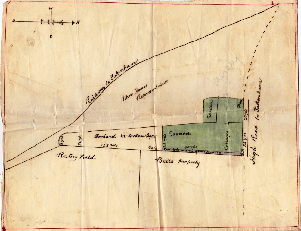
In some respects the map dissappoints because the footprint of the buildings is very ambiguous. There are however specific measurements of the street frontage and the naming as "Chapel" of the building that becomes the Marine Tavern, makes this a very valuable document. In the conveyance, Tatham describes the purchase of "the cottages and Ranter's Chapel now or late standing on the same piece or parcel of land"
Tatham retains the orchard portion that adjoins Rectory land and is insistent upon the road remaining as an 8 feet wide access to his orchard.
At this point we need to find reference to this plot in the Census returns and we find in 1861 on page 16 of the schedule, immediately after 79.,"The Railway Station" and 80., the "Grocer and Draper's shop" where Michel Mesney and family lived, and a single dwelling 81., the following:
The "Primitive Methodist Chapel" with no number in the Schedule followed by 83., a single dwelling housing Widow, Sophia Best described as "Proprietress of Houses" , her sister together with a "Boarder" , a Scotish Forester employing 9 men and a "Lodger" who was a carpenter.
Turning to page 17 we find 82., Beer House, again a single dwelling but this time housing Luke Ainger, his wife and 7 children together with 4 "Lodgers" all of them teenage Woodmen from Suffolk. This alteration in the numerical order was presumably to avoid the Ainger's lengthy entry carrying over two pages.
This Census then moves away from the Marine Tavern plot.
Going back to the first Census of 1841, We find no entry for Sophia Best, no mention of a Chapel and there are no schedule numbers. However assuming there were 3 dwellings and using the entry for Luke Ainger described as "Publican" and Michel Mesney, we can deduce that the cottages on the plot were occupied by Francis and Mary Howman and their then 5 children and William and Elizabeth Bird and their 2 children.
The 1851 Census now with schedule numbers, once again gives us No 79 Luke Ainger "Ag Lab and keeps a Beer shop" No 80 is widower John Eggleton his housekeeper daughter and a lodger. No 81 is widow Sophia Best,her widowed mother, sister and niece together with a house servant. Sophia is described as "Farmer of 6 acres land"
At this stage we need to look at further depictions of the buildings , which although later than these census dates must give some idea, in conjunction with the maps above, of just how many dwellings there were.
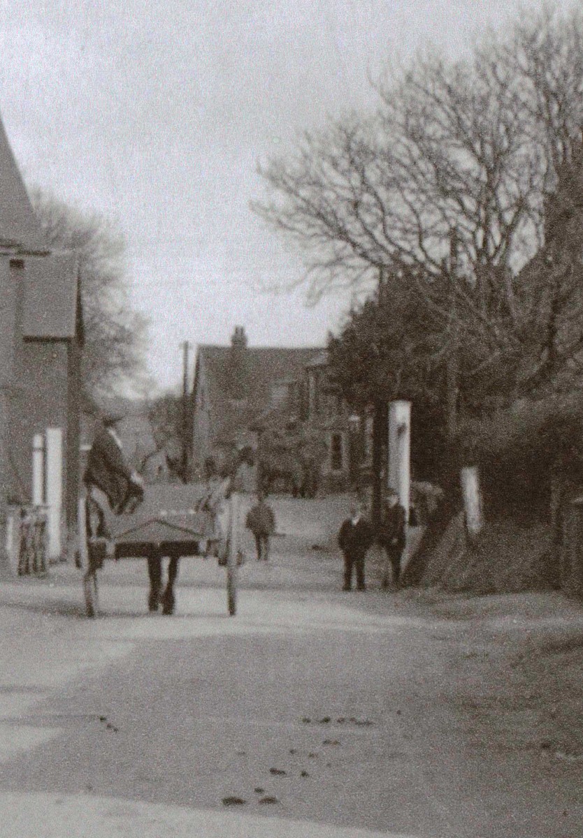
This is a detail cropped from a view of the railway crossing and shows, probably post 1904, the substantial cottage/s that stood gable-end on to the roadside where the telephone exchange buildings now stand.
Looking forward to the 1871 and 1881 Census returns, these both suggest that there are 4 dwellings on the plot as 4 entries are found in between the Railway Tavern and Marine Tavern before Michel Mesney's farm and the Grocers & Drapers. Soon after this in 1886, the 6 inch to the mile Ordnance Survey Map was produced and shows quite clearly that the Ranter's Chapel site had been extended about 2 metres into Mesney's farm buildings on the street and was now double fronted with bay windows
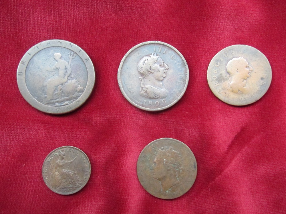
Coins found in the floor space during renovation in 1979 in the area where the old chapel building has been incorporated into the current double-fronted aspect are all dated between 1797 and 1826 which predates by about 50 years the building work which created its present external appearance:
Several photographs/ postcards show the house with its Steward and Patteson sign and must therefore date from after 1904. These years saw further building work which is quite likely the last time major changes happened to the house before the purchase by the previous occupants in the early 1970's when the house was modernised with damproofing and indoor toilet and bathroom facilities. The cellar at the South East Corner was probably filled in in the 1930's with evidence of the barrel access to the cellar finally removed in the early 70's.
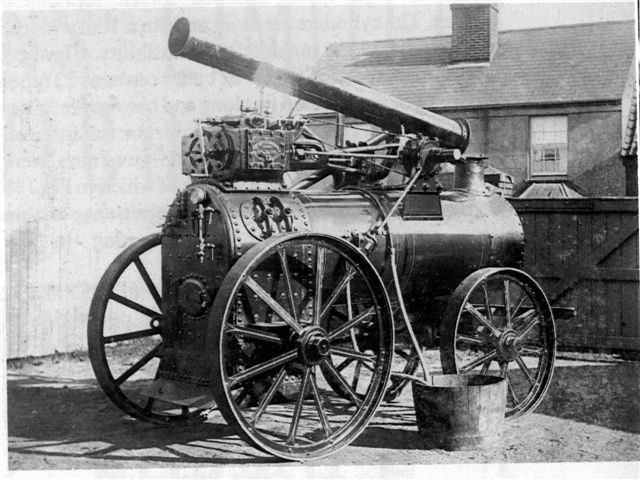
A photograph showing the roofline above the gates of the foundry opposite show a slated roof with a central chimney stack and portrays a Farmers Foundry Portable Engine. (Was this the first one being photographed for the first time one wonders?):
The purlins in the roof which are extended to carry the roof into the Mesney's outbuilding show the clear cut-outs made to fit round the central stack and some evidence that there had been a certain amount of charring of the rafters that once surrounded the stack! There is now a stack on each gable end.
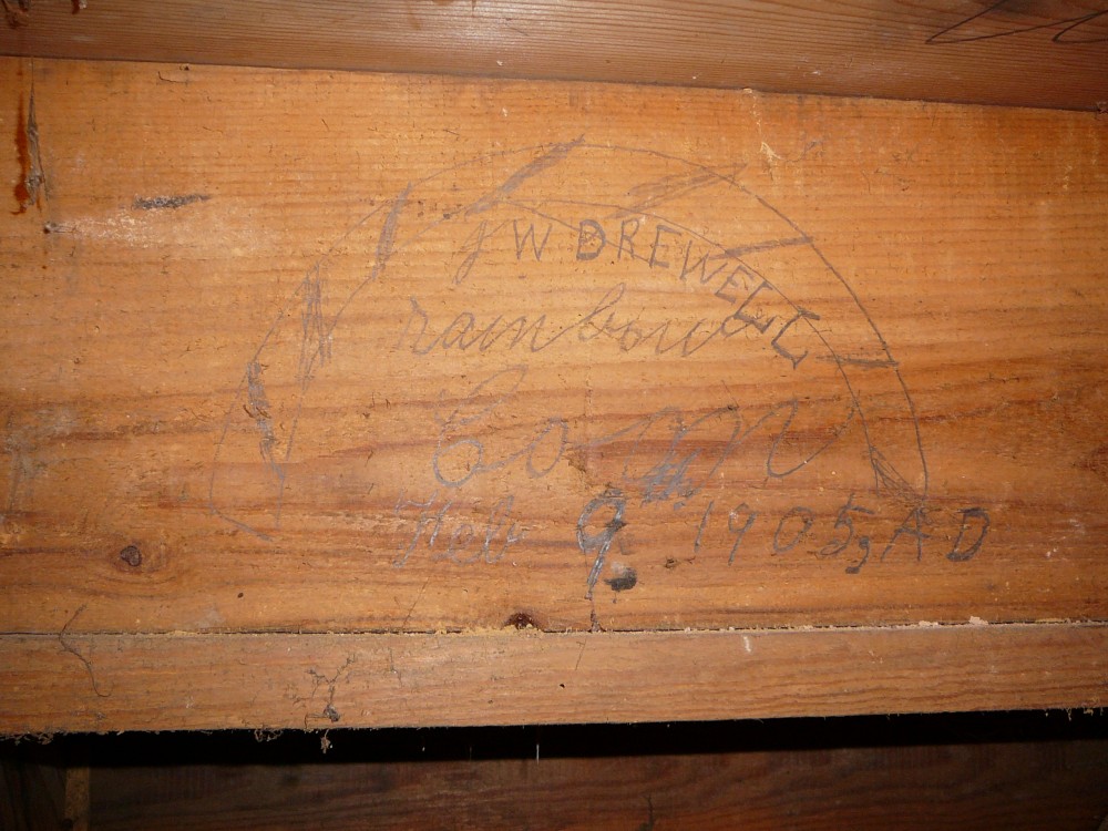
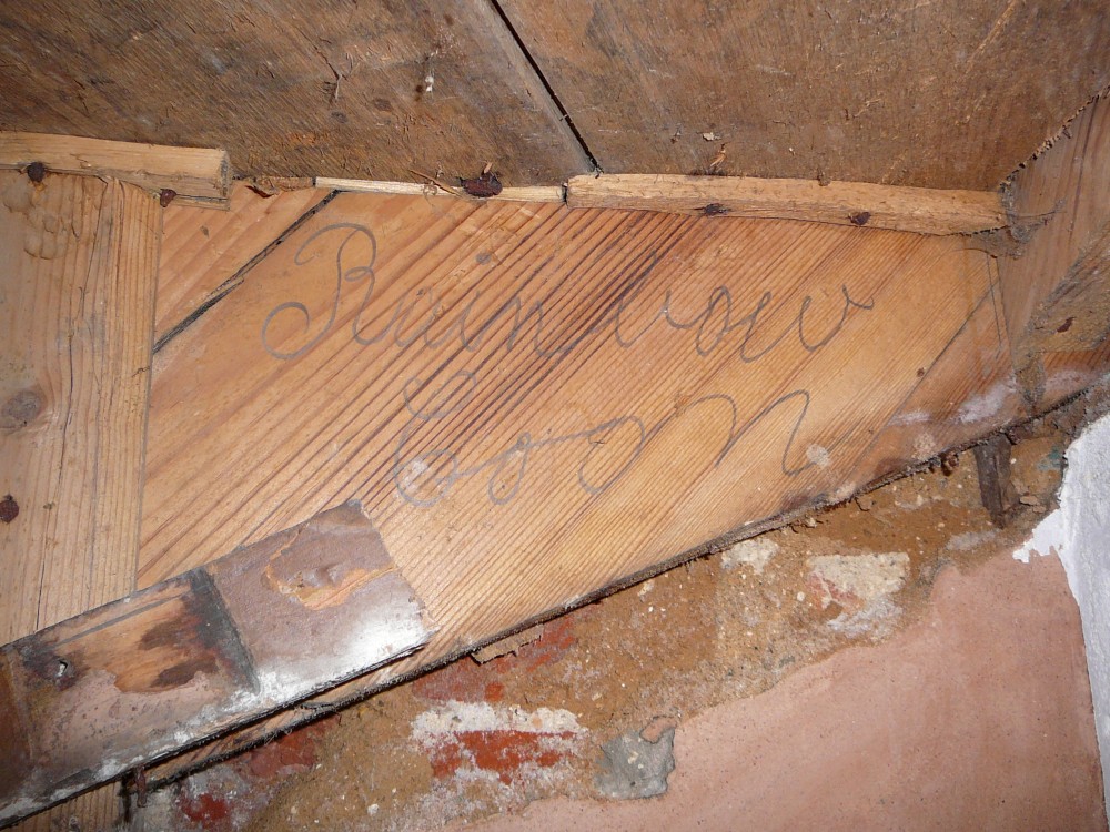
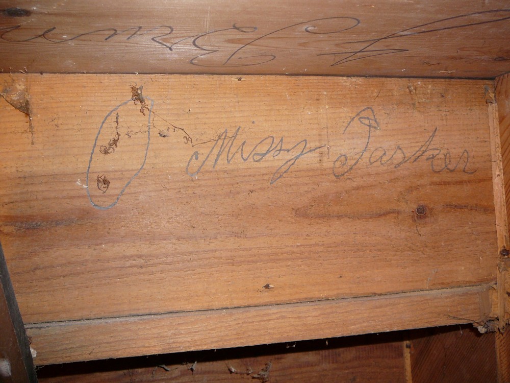
The insertion of a new staircase in 1905 from the outshot through the old external rear wall and along the former boundary wall of the chapel is probably when this chimney was removed along with the staircase/s that went up in the room space/s above. Grafitti dated 2 November 1905 on the underside of the treads gives us, one assumes, the names of some of those involved. The surname "Drewell" is the only one so far to have any connection with Ryburgh but of a century earlier. George W. Drewell was the Station Master in 1891 from Beccles and therefore something of a red herring :
The licensee from November 1881 to 1906 who must have seen the majority of the above changes was Ellis Daines. He took over from his brother-in-law James Colman who had the license from 1879. We are fortunate that Ellis' image has survived along with his son Harry on the splendid photograph of 1901 depicting Maltings employees:
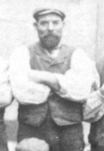
Ellis Daines (aged 54)
Harry Daines (aged 21)
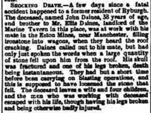
The British Newspaper Archive is the source of a sad event in the Daines family life when the tragic death of his brother John is reported in the Norwich Mercury 15th December 1888 :
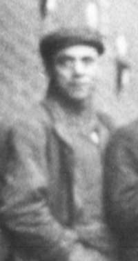
After the sale of the property to Steward and Patteson the licence went to another Malting's employee John "Jack" Coates His image turns up severally, the earliest taken when he was a member of the Ryburgh Platoon of the 4th VBNR. He is named on a photograph of the Platoon circa 1894, held at Gressenhall Museum and is the clearest image we have:
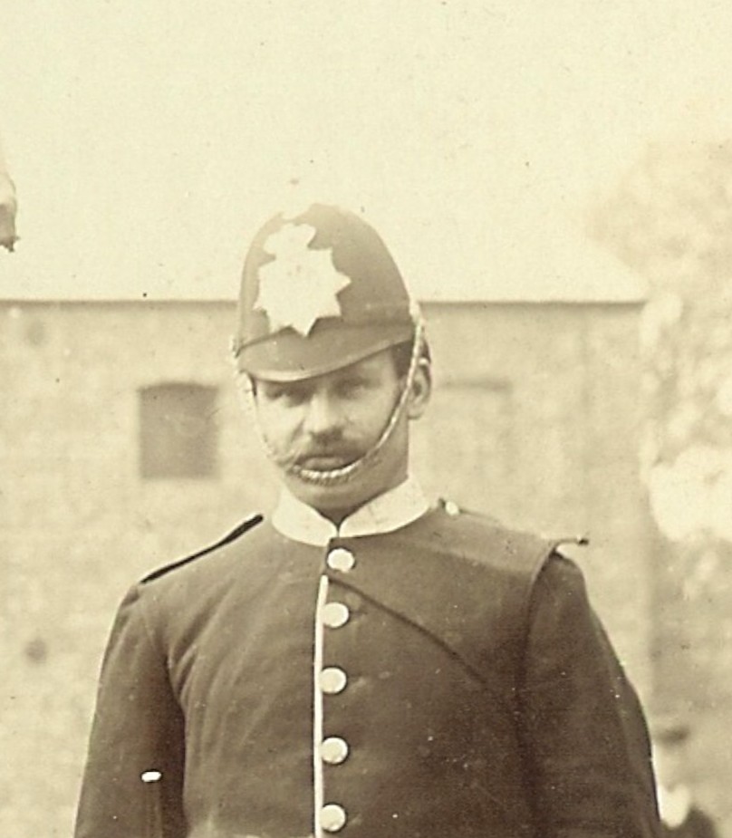
Jack Coates (aged 24)
He also appears on the 1901 Malting's photo where he was employed as a stationary engine driver. His father Abel and probably his Uncle William are also on that photo.
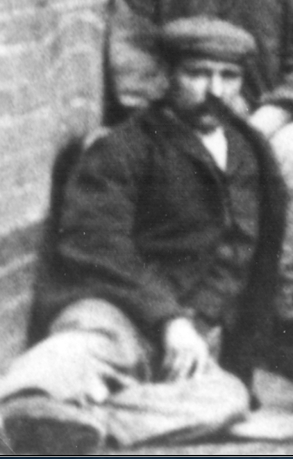

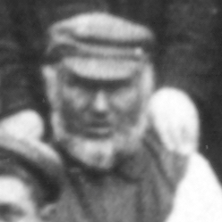
Jack Coates (aged 31) William Coates (aged 50) Abel Coates (aged 55)
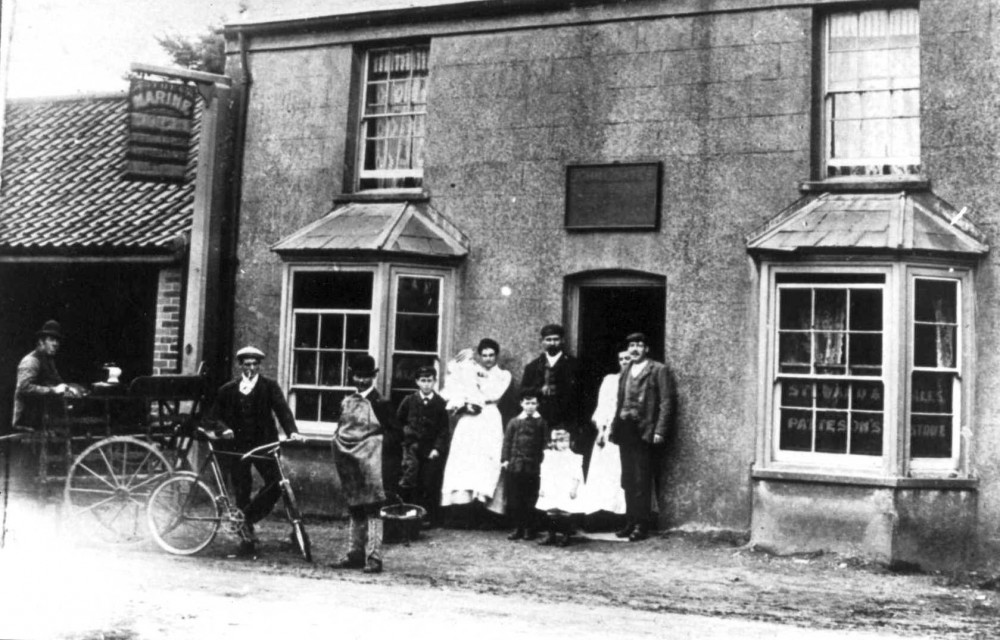
The photograph below, which is a copy of a copy of a copy of a card that posted in 1908 and now in the possesion of the Norfolk Pubs website, shows the pub during the tenancy of Jack Coates. The name is faintly visible on the board over the door. Is he on the picture with one assumes family members and does he match the images above? My conjecture is that the woman with the baby is Ethel Harriet Coates (nee Rye) with their youngest child Harry, born in 1907. John Coates stands next to her and the two children in front of him are their eldest John, born in 1901 and Elsie Mary, born in 1905
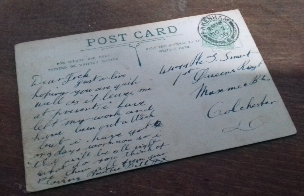
Norfolk Pubs have kindly sent a scan of the reverse of the card which as yet supplies no clues as to the identities:
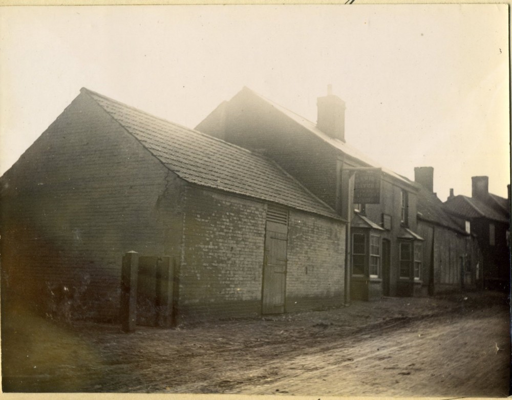
They have also kindly supplied another, earlier image that was contained in an album of Steward and Patteson Houses and is dated 1898 and must substantially represent the street view of the remodelling after the sale to Michael Mesney. This means that the dilapidated stable building was probably demolished, creating the open fronted building, after the purchase by S.&P.:
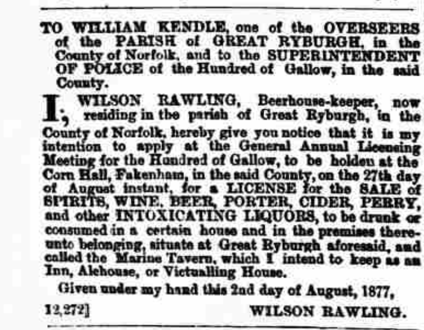
The British Newspaper Archive has turned up a press notice from Norfolk News 4th August 1877 announcing the intent of Wilson Rawling to take on running the pub in its enlarged and double fronted form when he applied for the Licence. The previous day, Thomas Hagan had posted an identical application notice for the Railway Tavern (Bullards) which was on the adjacent plot of land. There was clearly a market for their services at the time and one hopes friendly rivalry between them!
The Lynn Advertiser also covered the simultaneous demise of the two establishments in February 1930 in their reports on the licence renewals in the Gallow Hundred.
The 7 Feb issue reported "All existing licences were renewed with the exception of the 'Railway Tavern' and the 'Marine Tavern' Ryburgh which are under consideration"
On Feb 28 they were duly considered and explanations given:
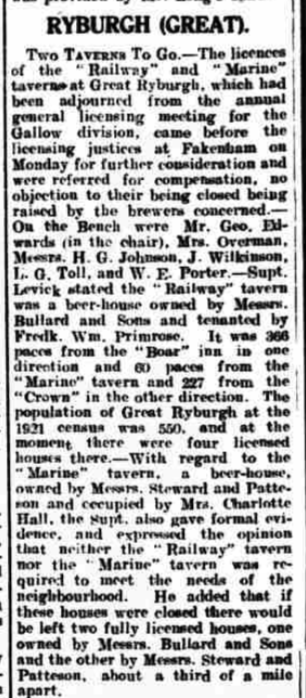
Their fate was reported in the following year "Supt. Levick, in his sixth annual report, said there were...... total 46 [Licensed premises] (two less than last year, the "Railway" and "Marine" taverns at Great Ryburgh having been closed with compensation).There was and average of one licence to every 202 inhabitants." in the Gallow Hundred.
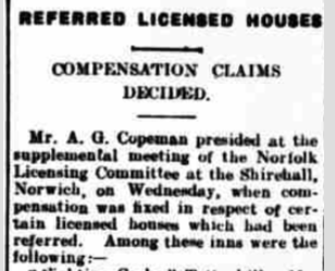
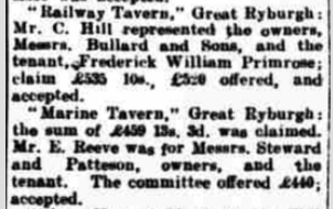
The details again from the Lynn Advertiser on October 17 1930:
More to follow