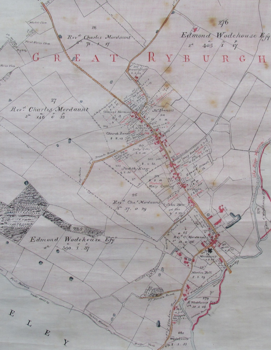
The details of the 1808 Act of Parliament present our village in very much the same way as today, that of a long road lined on both sides with housing and farms and surrounded on all sides by a large estate, at that time principally owned by Edmond Wodehouse.
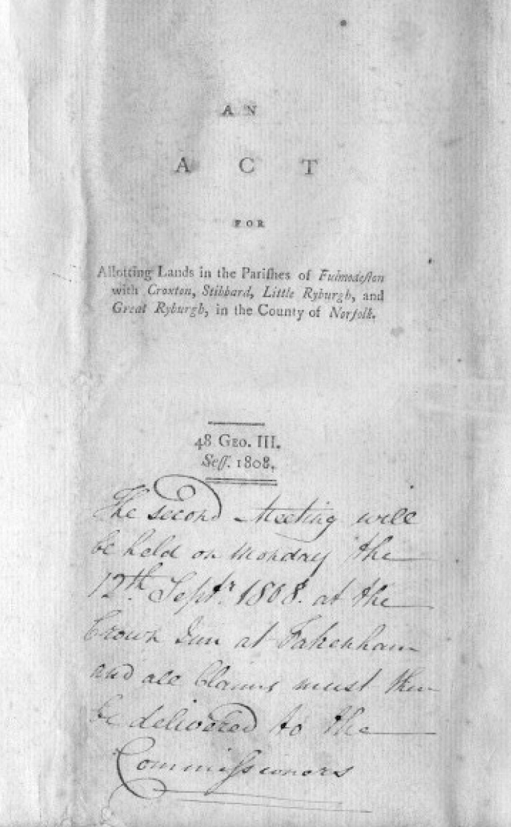
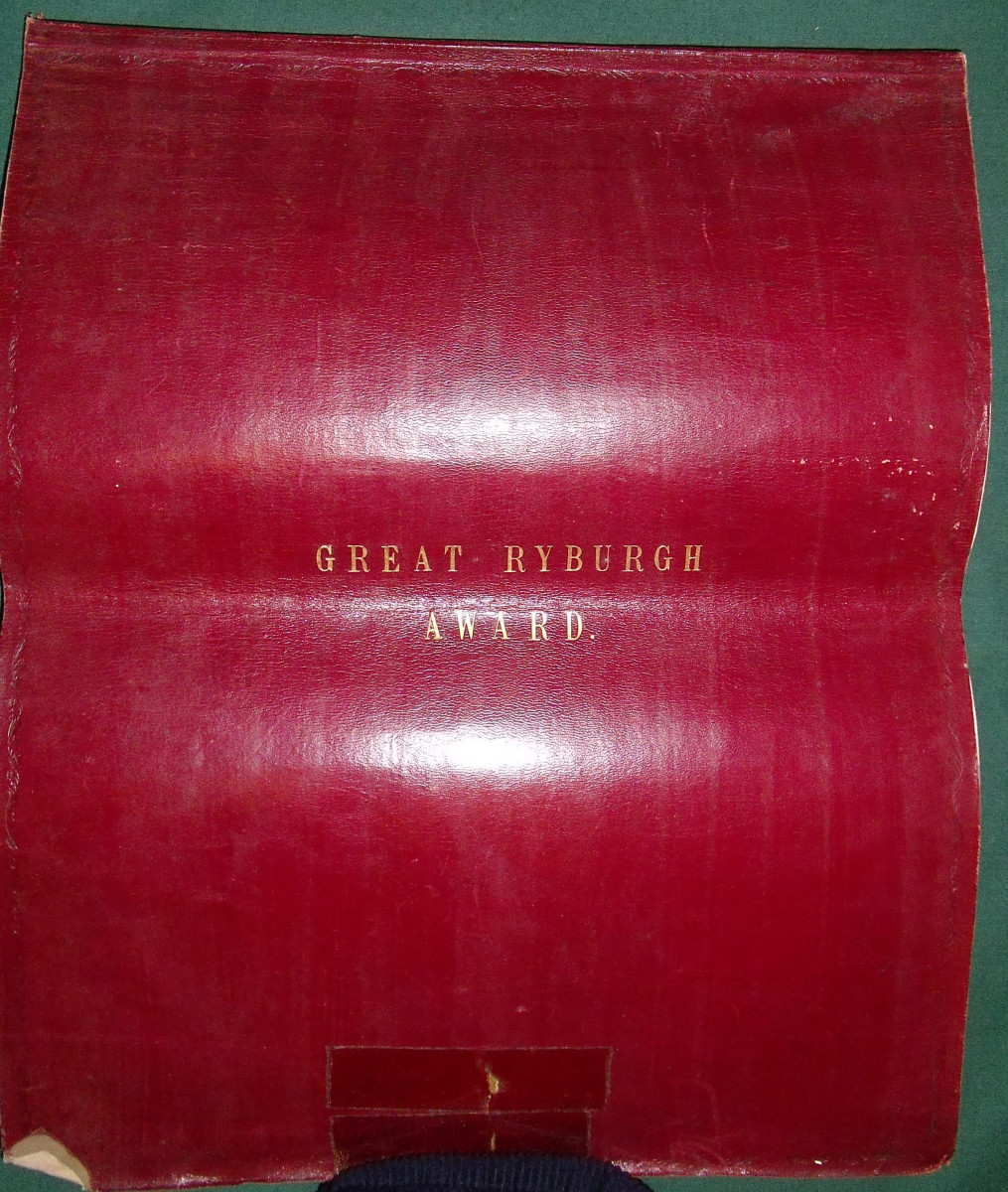
The Act itself can be viewed here in full. This copy was once in the possession of the Clerks to the Commissioners, Fakenham Solicitors William Stokes (Senior and Junior). The cover notes the date of the 2nd public meeting of the process. Meetings, as with all the other associated public announcements were convened after due notice was given in the local papers of the day and specified in the Act. Public hearings of all sorts were often held at local inns and public houses. In this instance the Crown in Fakenham was the chosen venue.
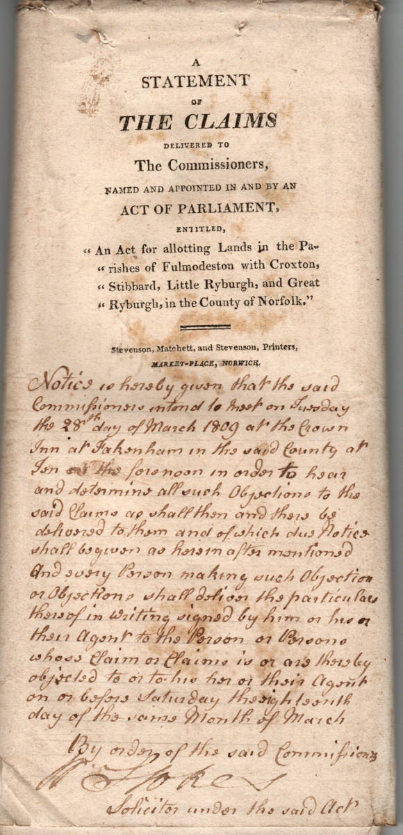
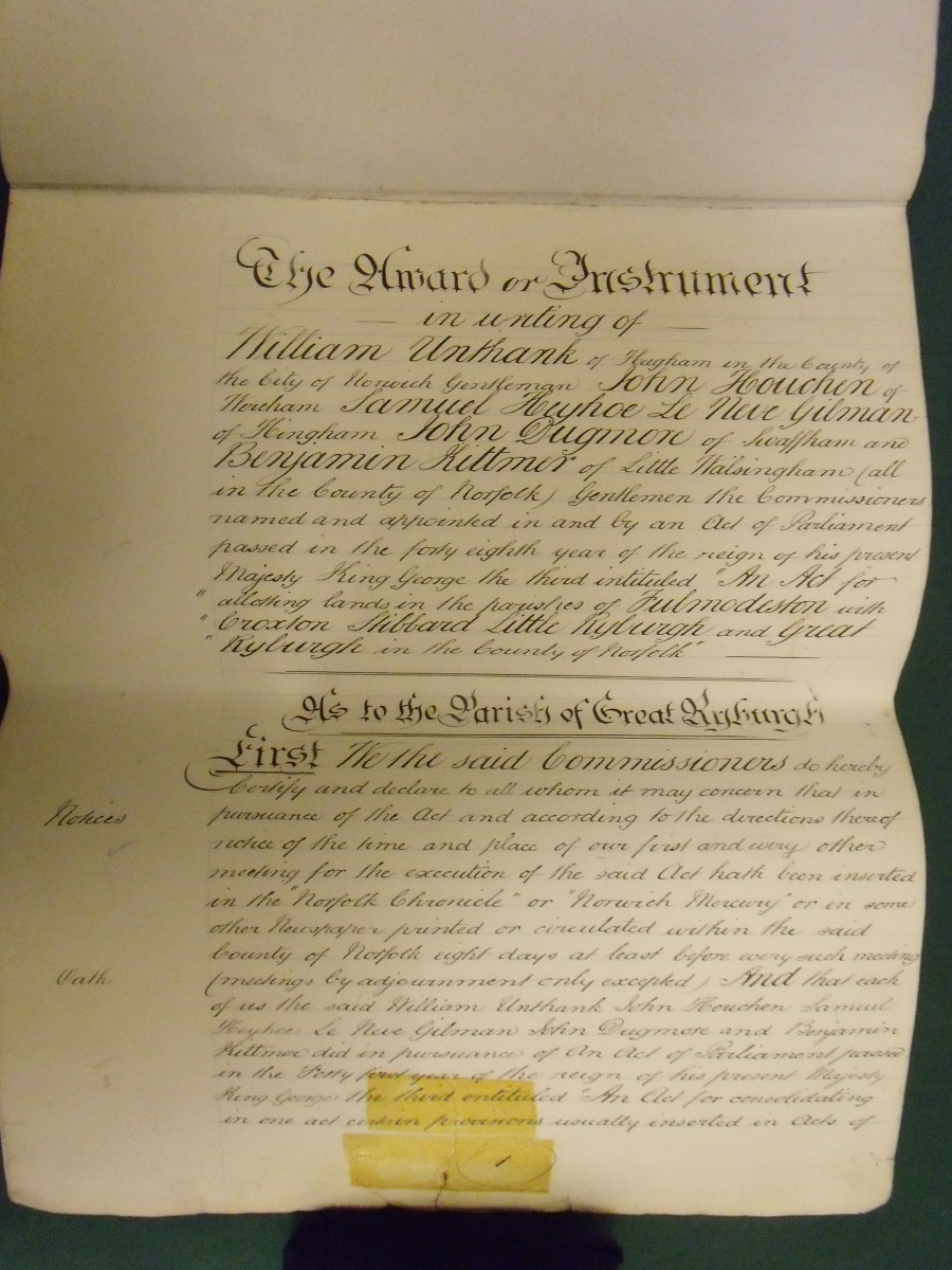
Among the first tasks of the appointed Commissioners for the Act, “Gentlemen” all (William Unthank, John Houchen, Samuel Henry Le Neve Gilman, John Dugmore and Benjamin Kittmer) were to determine and define the public roads and village boundaries and commit them to a detailed map. In addition, provision was made for private roads, fuel allotments, public gravel pits and fences together with the responsibility for their maintenance. Claims having been made, a printed Statement of the claimants to the various parcels of land was published, allowing objections to be made and settled by the Commissioners within a given time frame.
The Statement of the Claims document above runs to 39 pages, including one of additional claims and amendments. It was found in a collection of indentures, receipts and letters connected with one group of property in Great Ryburgh. Documenting a 200 year period from 1738, it must have come from a now dispersed "Stokes Solicitors" archive. At this time it was in the ownership of William Martin, Grocer of Kings Lynn. He made his Great Ryburgh investment in 1807 probably in full knowledge of the forthcoming Act and perhaps with an eye to to an increase in his fortunes!
If the name seems familiar it is because he was the brother of Matthew Martin who was Great Grandfather to William Martin, the little boy from Ryburgh who was one of the victims of the Norwich Hospital Murders in 1875. Matthew ran his own grocers business in one of his brother's properties and acted on his behalf as agent for the claims. Matthew was also one of the St. Andrew's churchwardens and so appears in the Inclosure's legal "writings" in his own right.
Among the bundle of documents there is a single page of further claims:
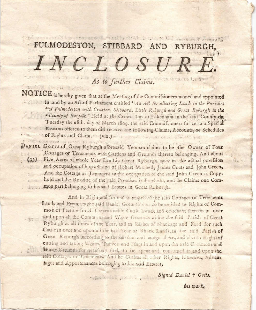
It was addressed to Mr W. Martin and perhaps may have had some bearing on his claims? However it is not possible to say except that Daniel Gotts' claim was evidently legitimate and his name, as a Freeholder and carpenter living in Ryburgh, is present in the Electoral Roll Books from 1768 through to 1806. The Gotts property he describes in the above claim is split between Thomas Gotts and Luke Gotts (who was allotted the larger portion) in the final award. This award made into 3 separate portions was/is a 5 acre plot on the South Eastern corner of Fakenham Road and Westwood Lane.
Daniel Gotts was buried somewhere in the churchyard at St Andrews on February 22nd 1810, aged 77 years. His wife Susanna had died 22 years previously in 1788 and there are no baptismal records of St Andrew's in the likely period of their births that can establish if Luke or Thomas Gotts were their children. They were nevertheless clearly relatives and beneficiaries of his estate. Luke as the freeholder continues to appear in the Electoral Roll Books until 1842-3 and is found living in Ryburgh in the 1841 Census with the status of "independent"
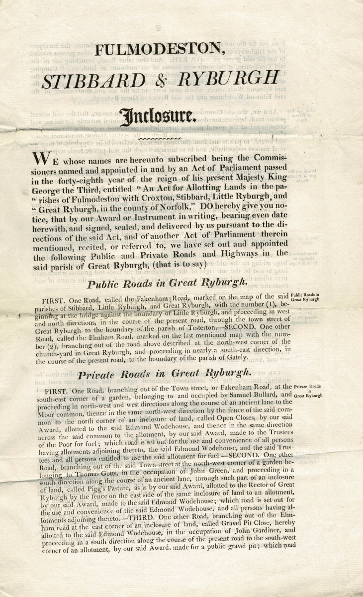
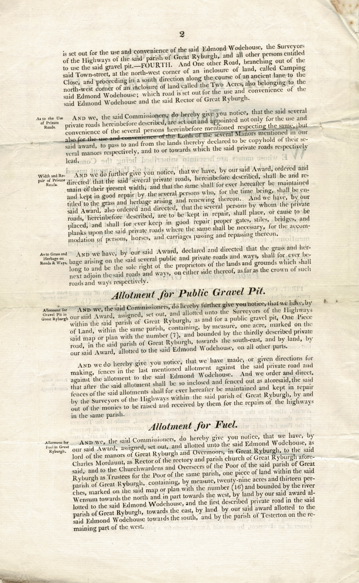
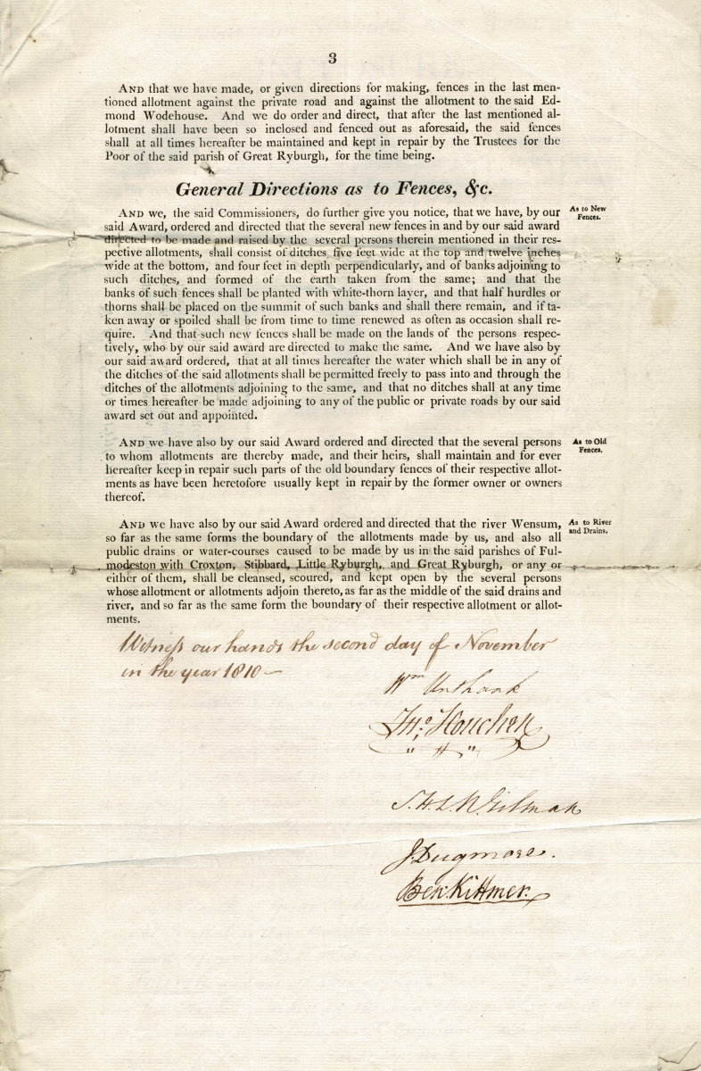
The Legal "writings” of the outcomes of the Act's Commissioners are comprised of 36 parchments of text and two maps, of which a copy is to be found in the Norfolk Record Office. Other copies of the whole text and of the individual parishes’ settlements, together with their respective maps were made. Below are the surviving examples for Ryburgh and are likely to have been typical for the remaining parishes. The map is a detail of the original that inclusdes "Sennhaugh"
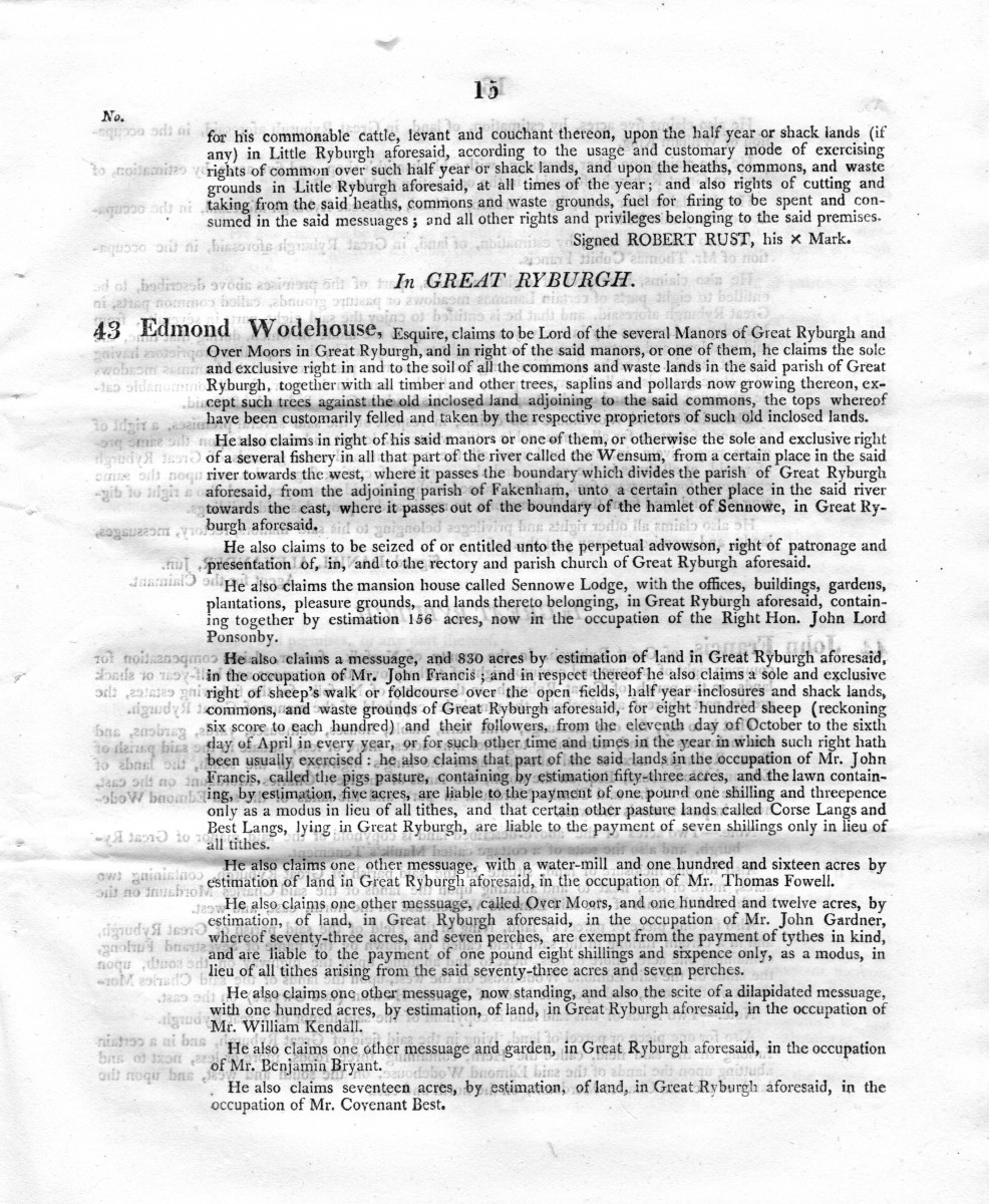
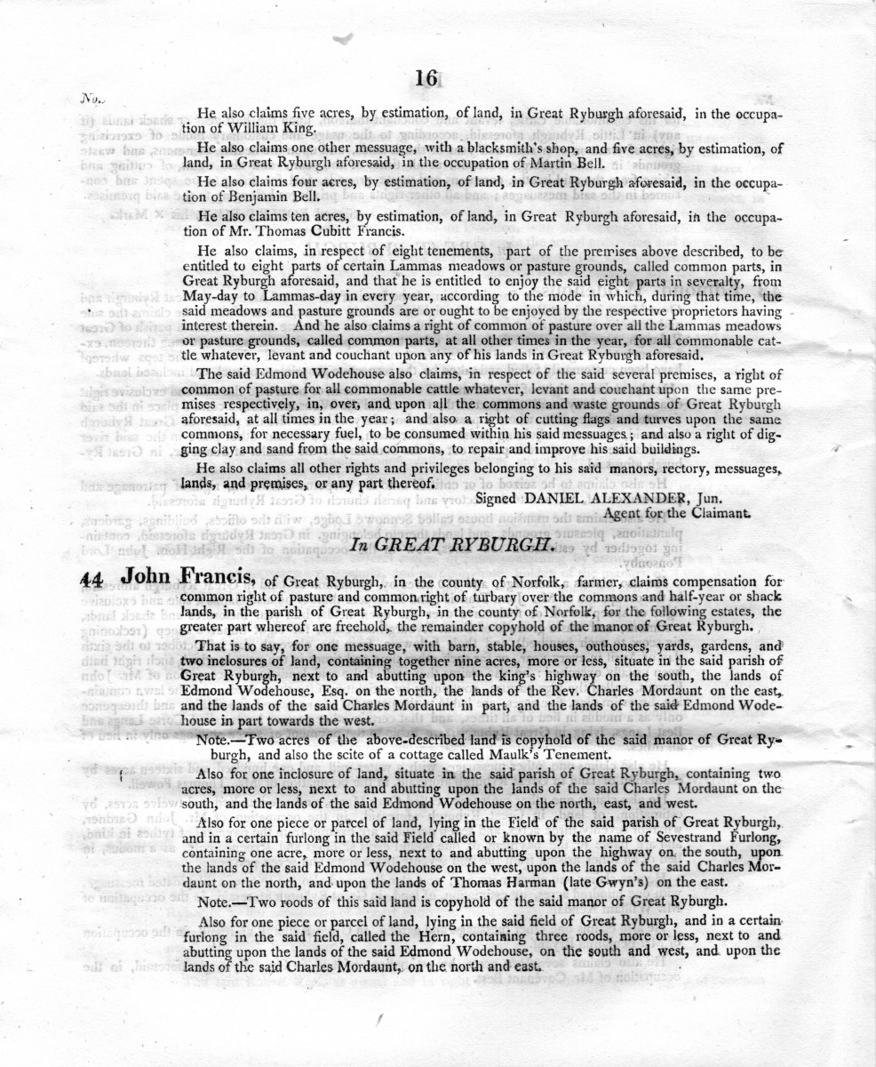
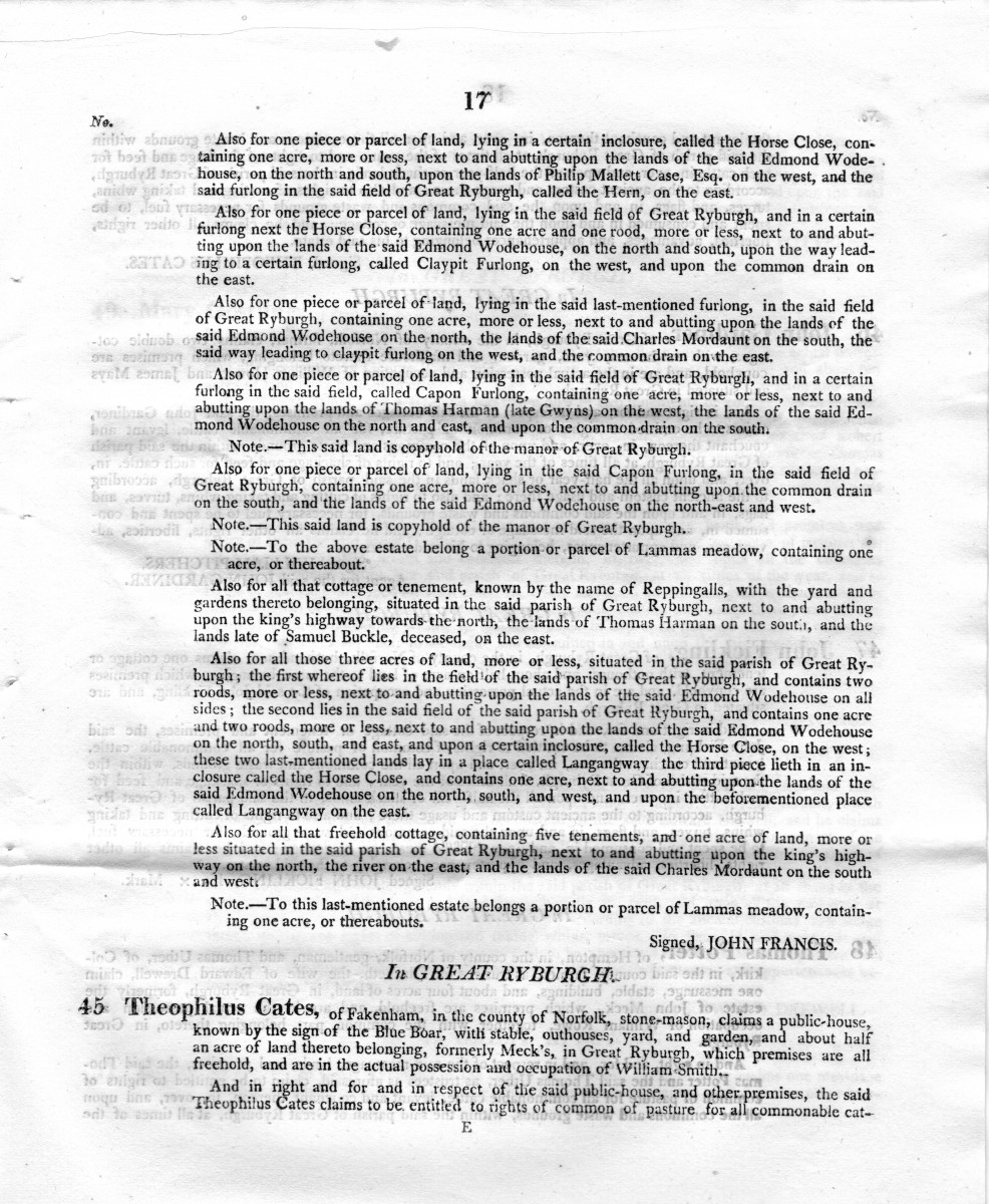
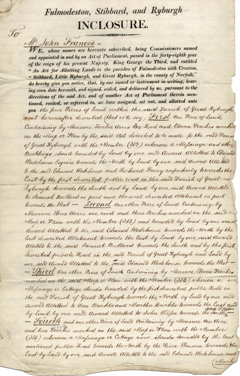
In the case of each Claiment a printed and written statment or receipt, endorsed by the Commissioners for the Act was produced. The following was provided for John Francis and was included in the deeds of Bridge Cottages identified in the document as the "fourth ....piece of land' . The first two images are of his original claim which describes several tradionally named fields and pastures and closes. What becomes the 4th award under the ensuing settlement is claimed in the last paragraph of the second page. The remaining five images state precicely what he was awarded and what the costs to him were:
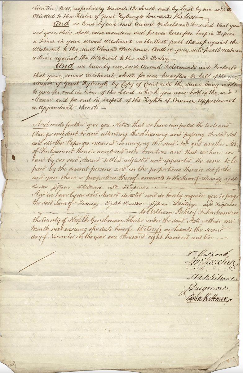
In general, most of the claimants made “the cut” and the majority of those successful claimants were responsible proportionally for the costs of the administration of the Act. The whole cost of the Inclosure across all the parishes was a whopping £4978 (pounds) -4/-(shillings) – 9d (pence). Great Ryburgh’s contribution was, if my sums are correct, £822-10/-0d. of which Edmond Wodehouse contributed £762-12/-0d of that sum. Every copyholder of the respective Manors had to update their agreements with new indentures for the costs of the stamp duty only. The exceptions to the consequential administrative fees were the Rector Revd. Charles Morduant, the incumbent and the Trustees of the poor. As seen above in the case of the Gotts award, circumstances changed, deals were made and lands exchanged or sold during the 2/3 years of administration to produce the settlement.
A quick overall look at the available documents presented here shows that the principle Landowner, Edmond Wodehouse, who in addition to leasing 156 acres together with the mansion called Sennowe Lodge, let the greater majority of his land to some of the biggest local farmers such as John Francis (830 Acres),who also held several properties in his own right. There were some small farmers as owner occupiers and others mostly from surrounding villages, who held property on smaller plots with dwellings upon them mostly rented out villagers. The commercial properties were also mostly tenanted such as the Mill with its 165 Acres in the occupation of Mr Thomas Fowell, also the Malthouse, Bake Office, Blacksmith's shop, Grocers and the two Inns (The Blue Boar and The Crown) all owned by people other than the respective occupiers and often not living in the village themselves. The calculated apportioning of the lands within the parish did away, at the stroke of the Commissioners' pen, with traditional rights associated with the land usage and with it a way of living that had pertained for hundreds of years. And of course, all this was principally to the benefit of the already well off and to the detriment of the poorest in the village. It is no wonder that the inclosures around the turn of the nineteenth century caused so much emigration from rural areas, not just to the towns but also to the colonies.